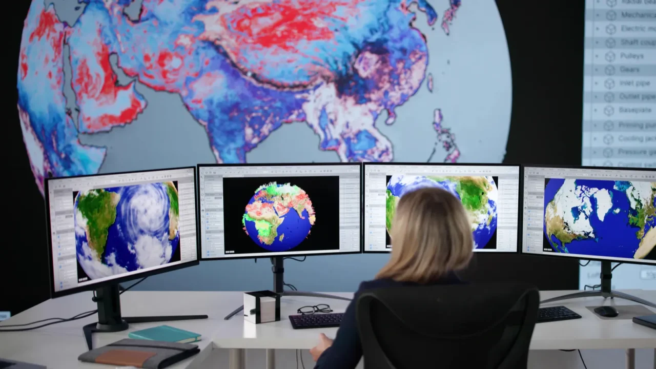
Global urban risk
Cities built in environmentally unstable locations are urban centers developed in areas vulnerable to flooding, seismic activity, subsidence, or extreme climate exposure. Geographic advantages such as trade access or fertile land often outweighed long-term environmental safety considerations.
Today, climate change intensifies these original vulnerabilities. Rising seas, stronger storms, and water scarcity force governments to reassess infrastructure resilience and sustainable urban planning strategies worldwide.
Jakarta, Indonesia
Jakarta developed as a colonial port on low-lying marshland beside the Java Sea. Rapid urban growth and excessive groundwater extraction have caused severe land subsidence, with some northern districts sinking by as much as 10 to 20 centimeters per year.
Monsoon flooding and rising sea levels worsen the crisis. Indonesia plans to relocate its capital, yet millions remain in Jakarta, confronting daily risks shaped by geography and decades of development pressure.
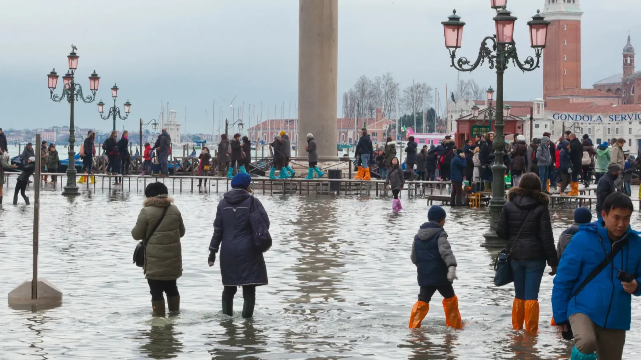
Venice, Italy
Venice stands on more than one hundred small islands in a shallow Adriatic lagoon. Timber piles driven into sediment support buildings that appear to float, reflecting remarkable medieval engineering ingenuity.
Seasonal high tides regularly flood streets and public squares. Rising sea levels now increase the frequency of these events, forcing implementation of the MOSE flood barrier system and extensive preservation efforts
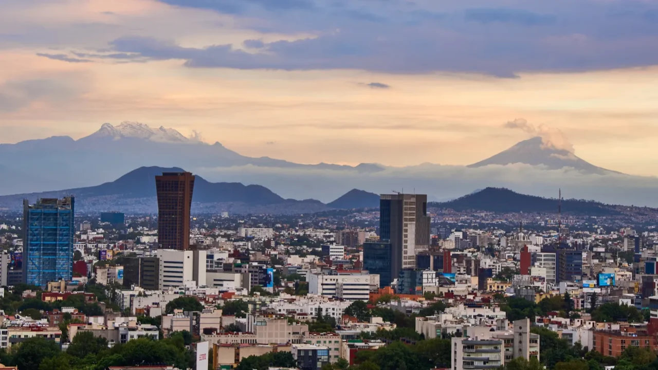
Mexico City, Mexico
Mexico City occupies the former Lake Texcoco basin, once home to the Aztec capital Tenochtitlan. Spanish colonizers drained the lake, transforming wetlands into dense urban ground.
Fun Fact: The city continues to sink because soft clay compresses under modern weight, a process widely documented by geological and hydrological research institutions studying long-term subsidence in the region.
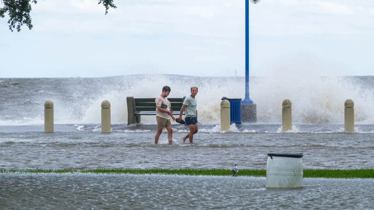
New Orleans, USA
New Orleans was established along the Mississippi River to control trade routes to the Gulf of Mexico. Much of the city lies below sea level, protected by levees and pumping systems.
Fun Fact: Hurricane Katrina exposed structural weaknesses in the flood protection network, later analyzed in federal investigations that identified major structural weaknesses in the levee system.
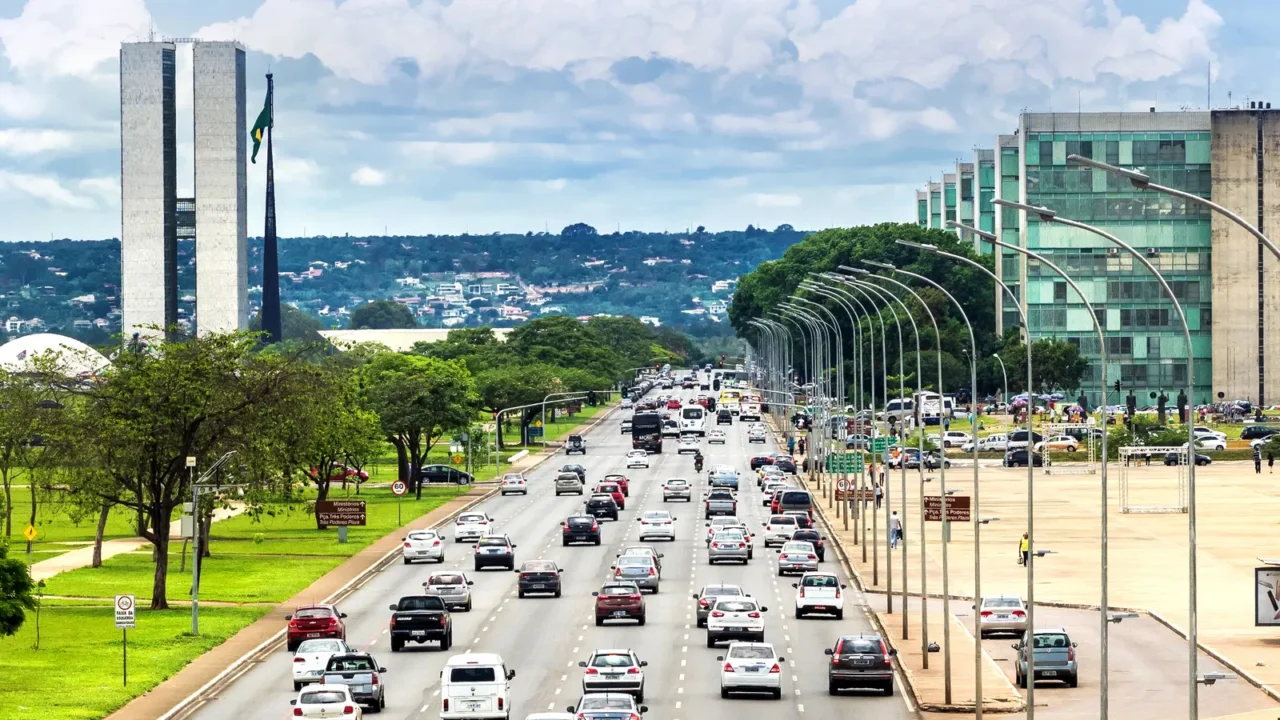
Brasilia, Brazil
Brasília was purpose-built in the 1960s to relocate Brazil’s capital inland. Its remote plateau location required massive infrastructure investment to support population growth and government institutions.
The city’s master plan, known as the Plano Piloto, was designed in the shape of an airplane or bird, reflecting modernist urban planning principles. Despite being far from traditional trade routes, Brasília continues to function as the nation’s administrative and political hub.
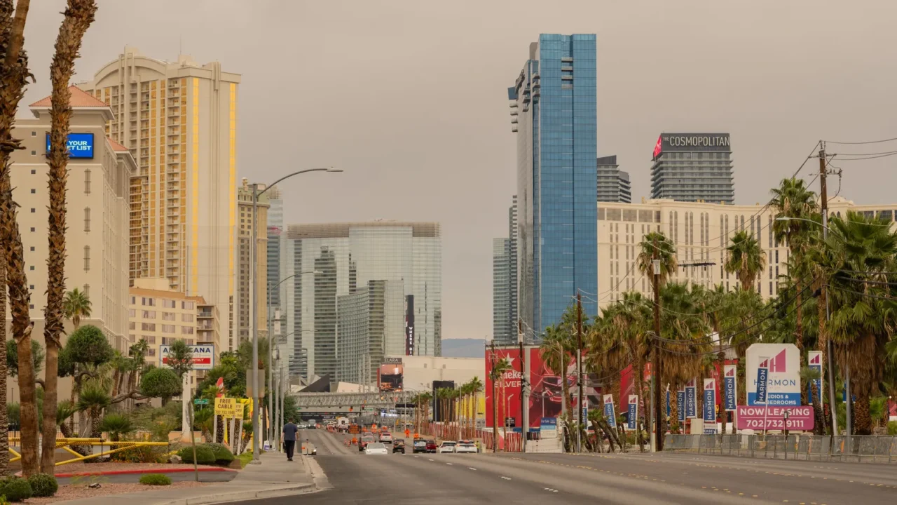
Las Vegas, USA
Las Vegas is developed in the Mojave Desert, an area defined by extreme heat and scarce water resources. Rapid growth followed the construction of the Hoover Dam, which provided both electricity and water for expansion.
Droughts and declining reservoir levels now threaten the long-term water supply. Urban survival depends on careful water management and sustainable growth strategies in this extreme environment.
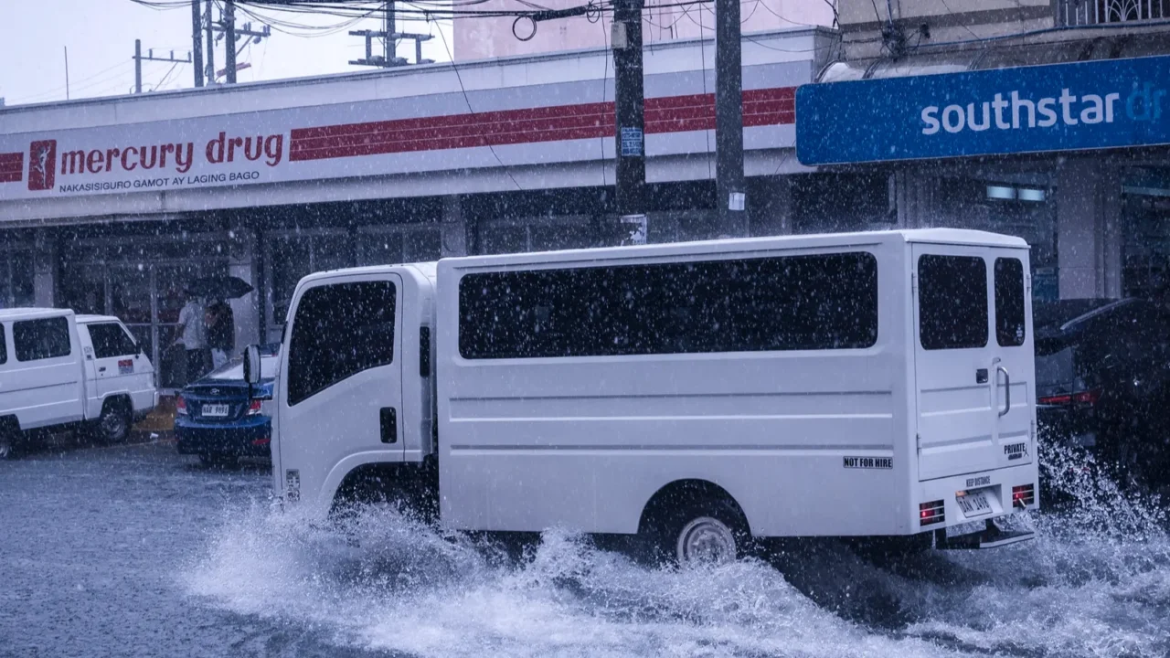
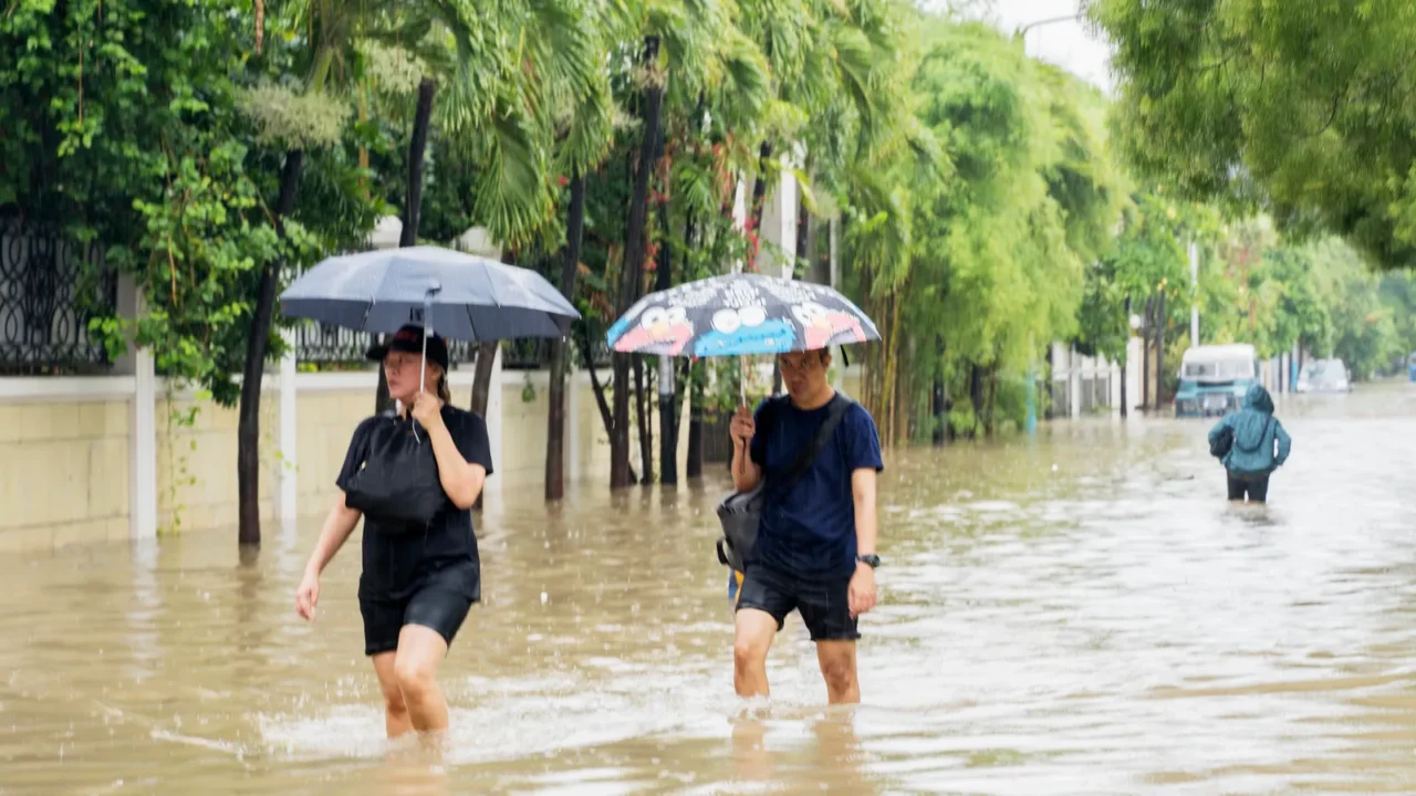
Manila, Philippines
Manila lies along a coastal delta frequently struck by Pacific typhoons. Its dense population and limited infrastructure make the city vulnerable to flooding and storm damage.
Despite these risks, Manila remains the economic and political center of the Philippines. Urban planners continue to address hazards while maintaining essential services and livelihoods.
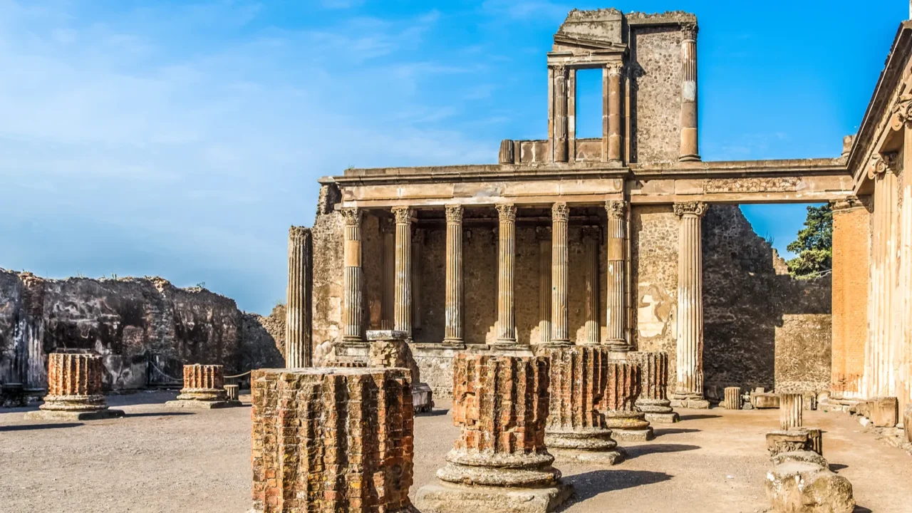
Pompeii, Italy
Pompeii thrived near Mount Vesuvius, benefiting from fertile volcanic soil that supported agriculture and trade. Prosperity often outweighed warnings of minor tremors in the years leading up to the eruption.
The eruption in 79 CE preserved homes, frescoes, and streets beneath layers of volcanic ash. Today, Pompeii provides insight into Roman daily life and the enduring power of natural hazards.
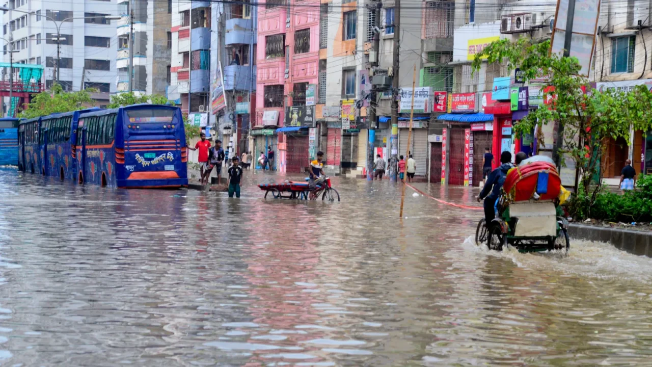
Dhaka, Bangladesh
Dhaka lies within the Ganges-Brahmaputra Delta, one of the most flood-prone regions in the world. Seasonal river overflows and cyclones impact millions annually.
Rapid population growth reduces drainage capacity, and rising sea levels increase long-term displacement risks. The city faces urgent planning and adaptation challenges to remain habitable.
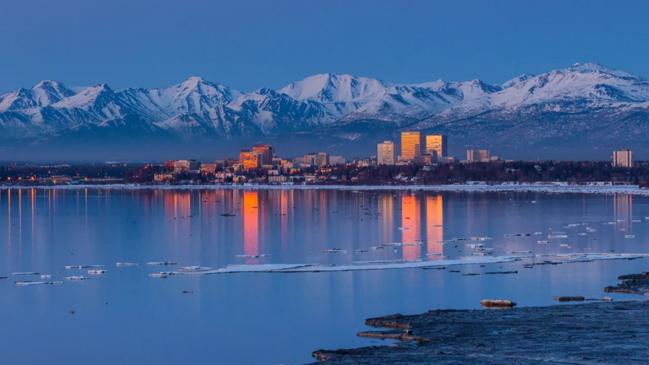
Anchorage, USA
Anchorage developed near active seismic fault lines along the Pacific Ring of Fire. The 1964 Great Alaska Earthquake, the second most powerful earthquake ever recorded at magnitude 9.2, reshaped urban infrastructure and building regulations in Alaska.
Permafrost and freezing temperatures complicate construction. While modern engineering increases safety, the underlying geological risks remain, making Anchorage a city constantly balancing nature and human settlement.
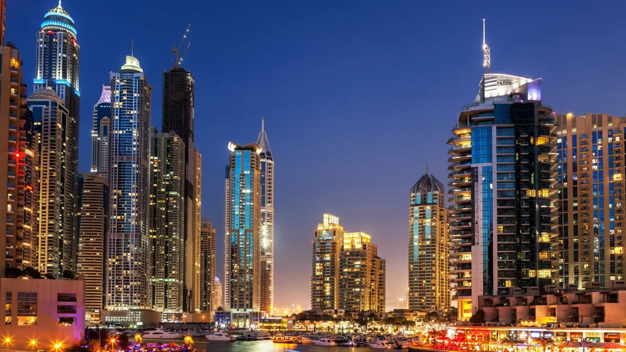
Dubai, UAE
Dubai expanded rapidly across the desert coastline through ambitious land reclamation and engineering projects. Artificial islands and waterfront developments extended the city into the Persian Gulf.
Extreme heat, water scarcity, and high energy consumption create ongoing sustainability challenges. The city’s success reflects engineering ambition, but its desert geography imposes long-term constraints, showing how cities around the world are tackling extreme environments to push the limits of urban design.
Global reflection
These cities reveal how early settlement decisions shape long-term risk. Trade advantages and fertile land once justified environmental exposure, but natural hazards remain persistent.
Climate change amplifies these vulnerabilities, forcing urban planners to respect geographic realities. This perspective highlights how many of these cities have transformed their unique geography and history into unforgettable experiences for visitors.
These cities defy nature. Would you dare to visit or live there? Let us know in the comment section!
This slideshow was made with AI assistance and human editing.
Don’t forget to follow us for more exclusive content right here on MSN.
Read More From This Brand: