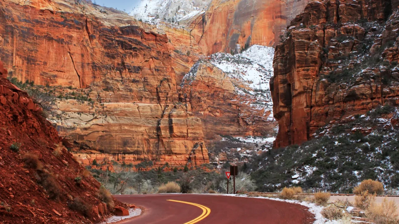
Utah’s geology is out of this world
Utah is famous for its stunning rock formations shaped over millions of years. The combination of uplift, erosion, and sediment deposition has created dramatic arches, hoodoos, spires, and colorful cliffs that attract visitors from all over.
The Colorado Plateau is the backbone of these landscapes, offering a layered geological story visible across vast canyons and cliffs. Whether you’re hiking a trail or spotting formations from a distance, the scenery feels almost otherworldly, with every turn revealing a new masterpiece carved by nature’s hand.
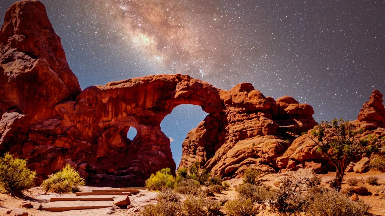
Arches National Park’s iconic arches
Arches National Park boasts over 2,000 natural sandstone arches, including the famous Delicate Arch. These formations are the result of millions of years of erosion sculpting Entrada and Navajo sandstone into graceful curves and delicate fins.
Visitors can explore whimsical shapes like the Parade of Elephants or balanced rocks, which add playful character to the park. Sunrise and sunset cast vibrant hues across the arches, making every photo opportunity feel like capturing the essence of Utah’s wild beauty.
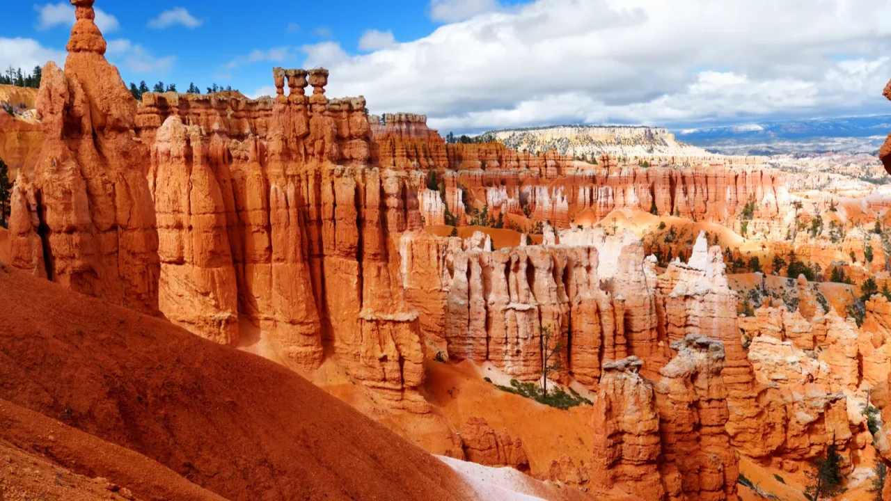
Bryce Canyon’s surreal hoodoos
Bryce Canyon is known for its thousands of hoodoos, tall spires of rock shaped by frost and erosion. The colors range from deep reds to soft whites, forming a landscape that changes with the shifting sunlight throughout the day.
Walking among these formations feels like entering a fairy-tale world. The park’s amphitheaters are perfect for hikes, offering panoramic views that highlight the unique geological processes responsible for this otherworldly terrain.

Monument Valley’s iconic buttes
Monument Valley features towering buttes that rise dramatically from flat desert floors. Composed of shale and sandstone layers, these formations are not only geologically fascinating but also culturally significant to the Navajo Nation.
Sunsets here are unforgettable, painting the rock in warm reds and oranges. Many visitors enjoy guided tours, learning about the geological history and traditional stories tied to each majestic butte.

Goblin Valley’s alien landscape
Goblin Valley is a quirky wonder filled with thousands of mushroom-shaped hoodoos called goblins. These unusual formations were created by uneven erosion of Entrada sandstone, resulting in clustered spires that look like a scene from another planet.
The valley’s strange shapes are perfect for photography and exploration. Visitors often marvel at the whimsical landscape, where every turn reveals a new, playful rock figure waiting to be discovered.
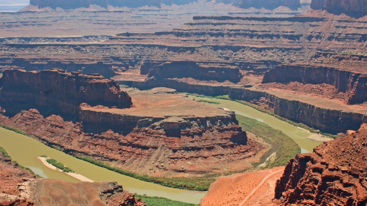
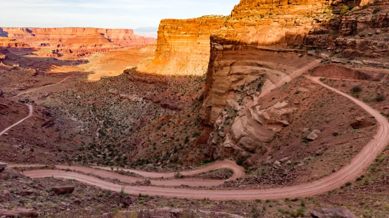
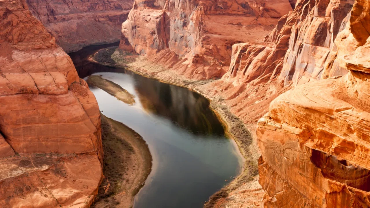
Dead Horse Point’s panoramic views
Dead Horse Point State Park offers sweeping views of deep red canyons carved by the Colorado River. The horseshoe bend below adds a dramatic perspective, making it a favorite for photographers and nature lovers alike.
The cliffs showcase the power of water erosion over millions of years. Hiking the rim trails lets visitors witness geology in action, appreciating the scale and intricacy of Utah’s natural artistry.
Canyonlands’ Needles district
The Needles District in Canyonlands is famous for its spindly sandstone pillars and vibrant, multicolored layers. Formations like the Druid Arch resemble natural sculptures, standing proudly among jagged ridgelines. The Needles area is renowned for its complex sedimentary deposits from ancient desert environments.
Hiking through the Needles reveals the diverse geological history of the area. Each rock formation tells a story of sediment deposition, erosion, and uplift that shaped this striking landscape over millions of years. The trails here allow visitors to experience geology up close in a dramatic setting.
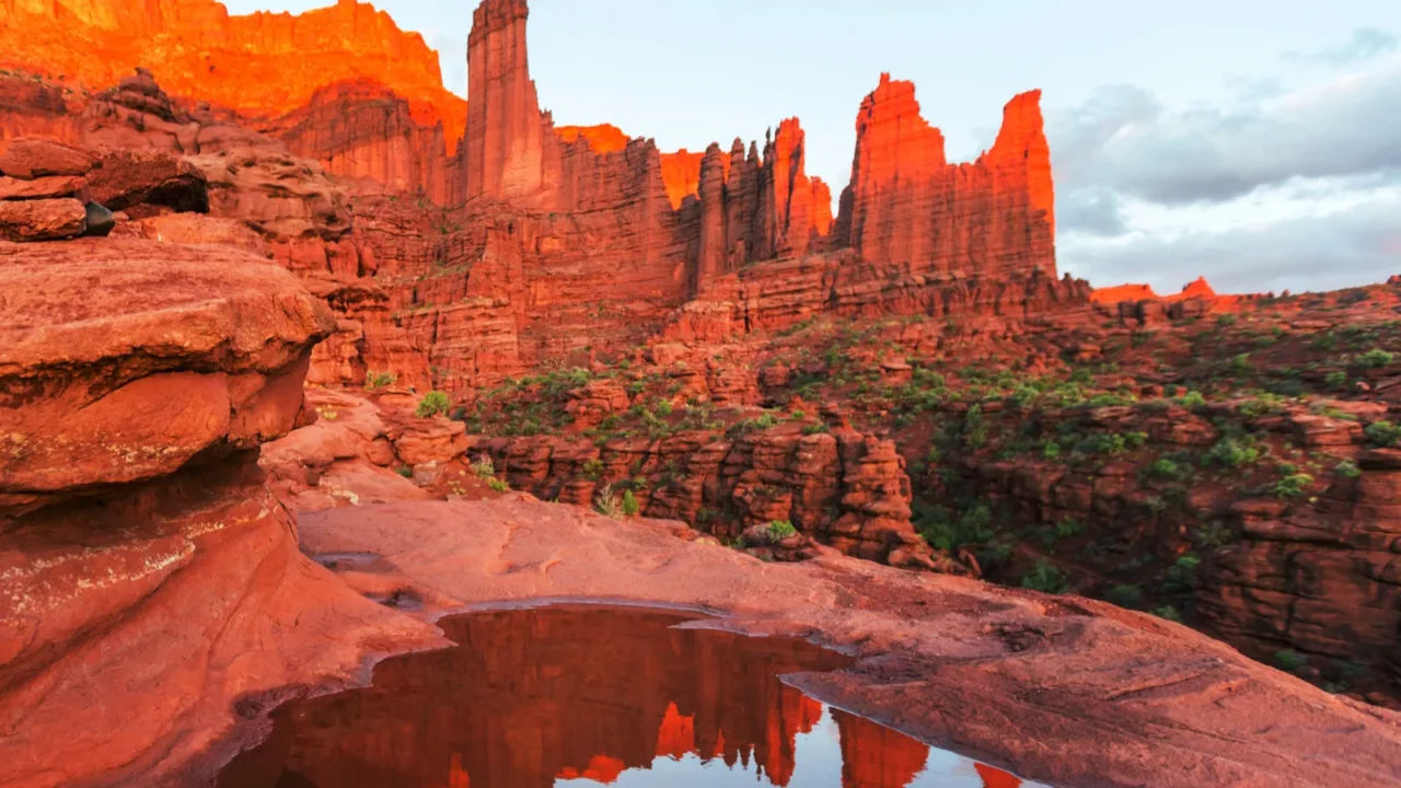
Fisher Towers’ towering spires
Fisher Towers is a collection of jagged sandstone spires and fins. The Titan spire reaches 900 feet, offering adventurous hikes with incredible views for those willing to tackle the terrain. These formations exhibit classic features of vertical jointing and erosion.
These formations are popular among climbers and photographers alike. The dramatic ridgelines and knife-edged cliffs illustrate how erosion can create breathtaking vertical landscapes that challenge and inspire visitors. Fisher Towers are part of the Colorado Plateau’s northeastern edge geology.
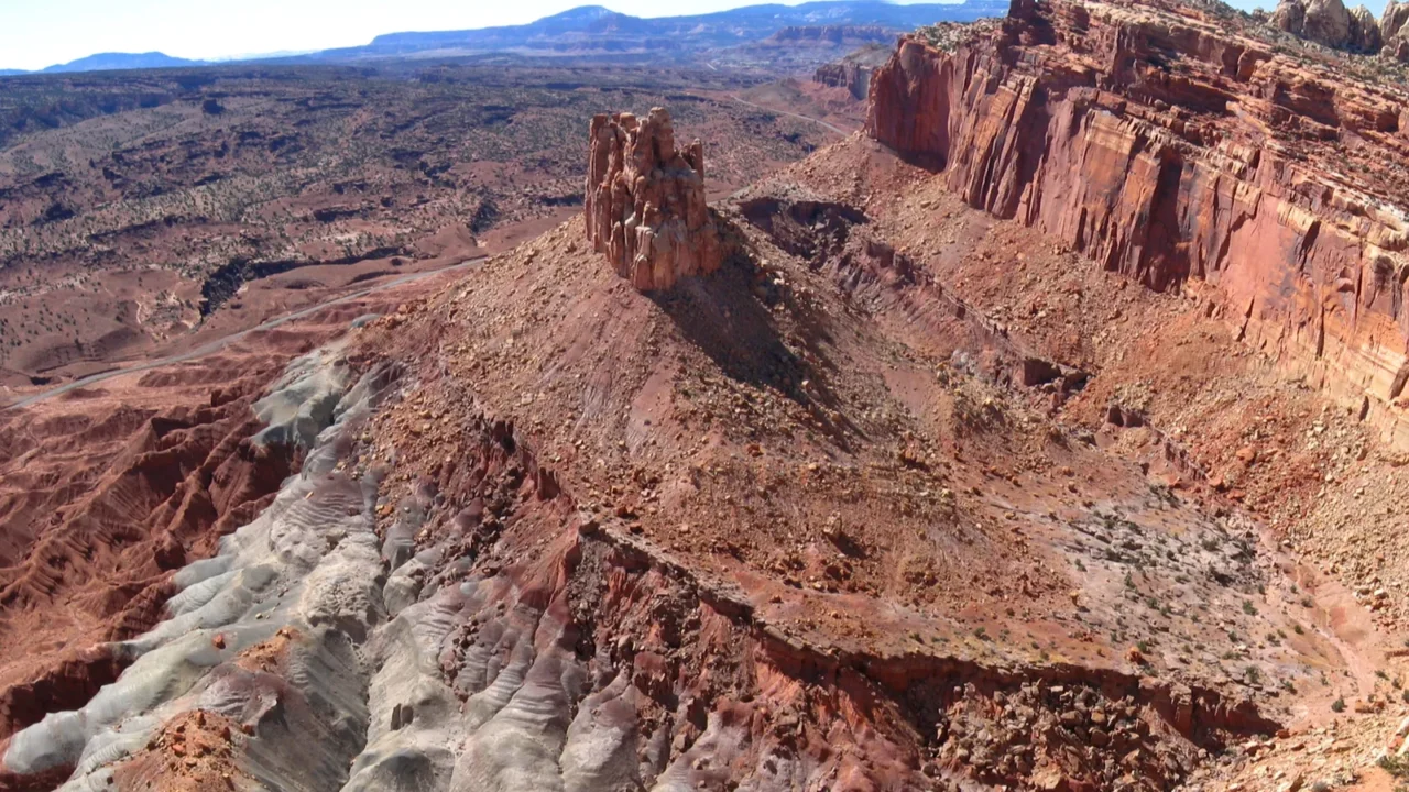
Capitol Reef’s Waterpocket Fold
Capitol Reef’s Waterpocket Fold is a 100-mile-long monocline, a massive wrinkle in the Earth’s crust. It has lifted rock layers thousands of feet, creating colorful cliffs, twisting canyons, and domes that showcase a cross-section of geological history. This unique geologic feature formed during the Laramide Orogeny about 50 million years ago.
Exploring this area highlights the dramatic forces that shaped Utah’s terrain. Visitors can hike or drive through the park, witnessing firsthand how tectonic movement and erosion create such striking scenery. The fold reveals a remarkable cross-section of sedimentary layers, many of which span hundreds of millions of years and offer insight into the region’s deep geologic past.
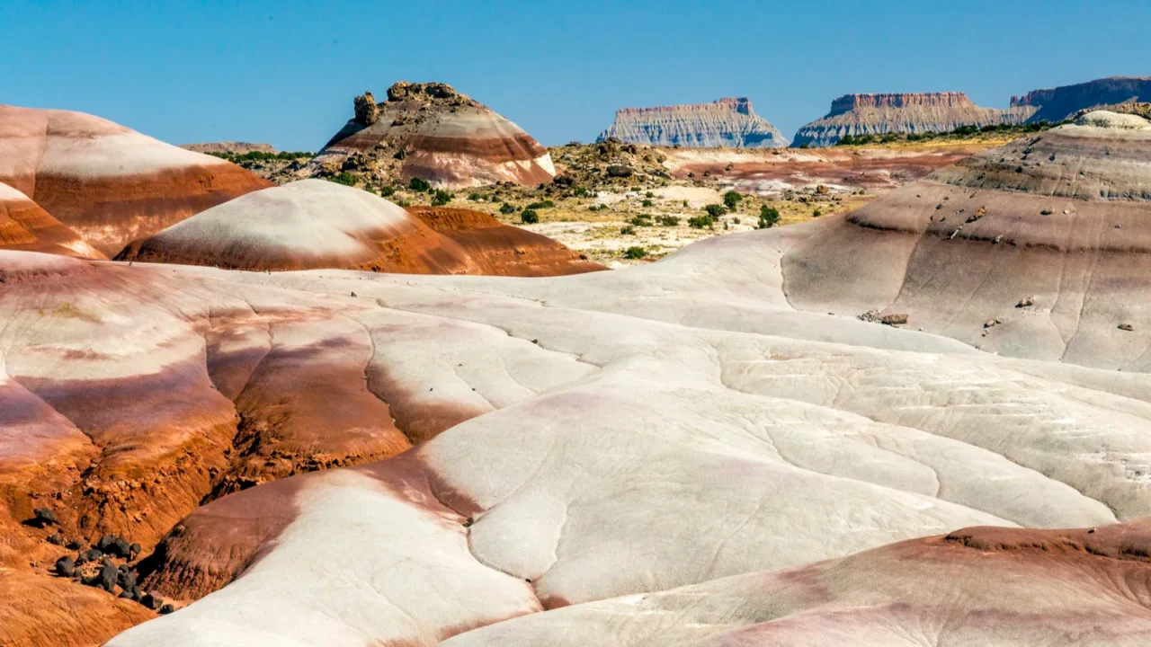
Bentonite Hills’ rainbow colors
The Bentonite Hills outside Capitol Reef display layered bentonite clay in vibrant reds, purples, blues, and greens. These rolling hills formed from ancient volcanic ash compacted over millions of years, creating a psychedelic landscape. The clay is rich in minerals that give it its unique vivid hues.
The vivid hues shift with sunlight, offering a constantly changing panorama. Walking among these hills feels surreal, making it a must-see for anyone fascinated by geological artistry. The area highlights the impact of volcanic activity on Utah’s diverse geology.
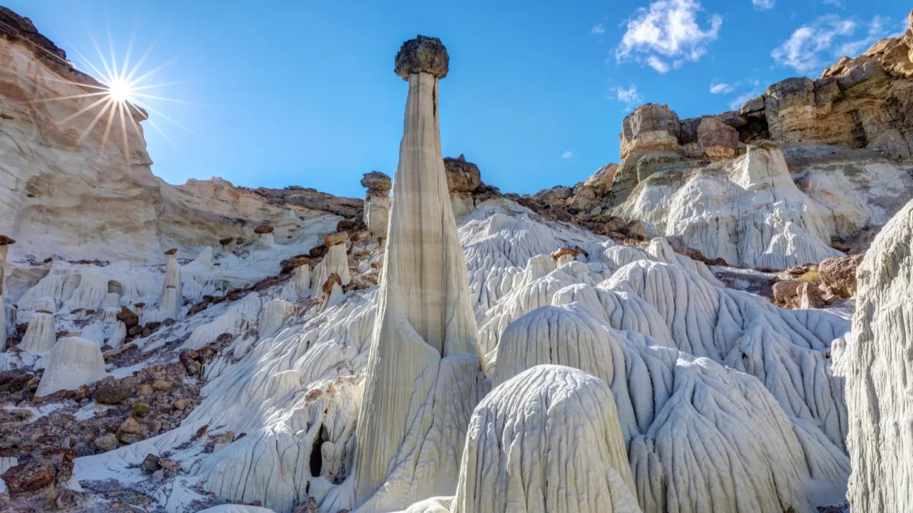
Magical Wahweap Hoodoos
The Wahweap Hoodoos in southern Utah feel like a hidden world carved by time. These pale, towering formations rise from the desert floor like ghostly sculptures, their white sandstone bases topped with darker caps that look almost unreal in the sun.
This area is often called the “Towers of Silence” because the landscape feels so still and untouched, with only the sound of wind moving through the canyons. Reaching them takes some effort, but the reward is a quiet, otherworldly scene that shows just how imaginative nature can be when erosion, wind, and water work together over millennia.
The science of erosion and deposition
Utah’s landscapes result from the deposition of ancient sands and silts, later shaped by wind, water, and frost. Softer rocks erode faster, forming arches, pillars, and hoodoos, while harder layers remain intact. Erosion rates can vary widely depending on climate and rock type, profoundly impacting landscape evolution.
Erosion, combined with tectonic uplift, has exposed rock layers representing millions of years of Earth’s history. Every hike, climb, or scenic drive is a lesson in how natural forces continually sculpt the Earth’s surface. Understanding these processes helps explain Utah’s remarkable variety of landforms.
Looking to explore even more hidden natural wonders? For your next getaway, consider exploring Arizona’s little-known slot canyons.
Combining nature and adventure
Utah’s rock formations aren’t just beautiful, they invite exploration. Hiking, photography, and rock climbing are common ways to experience the landscape up close. Many outdoor enthusiasts travel here specifically for the variety of adventurous opportunities the terrain offers.
From hidden canyons to towering spires, each adventure highlights unique geological features. Whether you’re a scientist, artist, or casual traveler, Utah’s rocks offer unforgettable opportunities to connect with nature.
Continue the journey with a look at Utah’s viral desert art and the powerful backstory that turned a remote installation into a statewide conversation.
Have a favorite rock formation or hiking spot in Utah? Drop your recommendations and stories in the comments.
Read More From This Brand:
- 15 historic towns in America where time stands still
- African American heritage trails worth traveling for
- Would you trust a robot to plan your next vacation?
Don’t forget to follow us for more exclusive content right here on MSN.
This slideshow was made with AI assistance and human editing.