Where the Desert Meets Discovery
Arizona is home to some of the most fascinating desert landscapes in the country. These places offer quiet trails, unusual rock formations, and wide skies that stretch far in every direction. Some are well-known, others more remote, but each one offers a unique view of the land.
Whether you’re traveling solo or planning a road trip, these seven destinations are worth adding to your list. Bring water, wear good shoes, and take your time exploring what makes each of these spots special.

Monument Valley
Located on the Navajo Nation, Monument Valley features wide plains dotted with tall rock formations. These formations have been shaped by erosion over millions of years. Visitors can drive through the scenic loop or book a guided tour to learn more about the land.
Sunrise and sunset are popular times to visit, as the light changes the colors of the stone. This location is often featured in films, but it offers a real and quiet beauty best experienced in person.
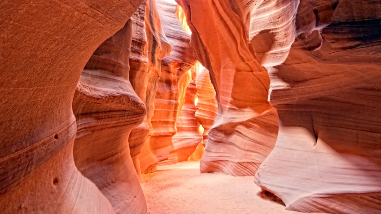
Antelope Canyon
Antelope Canyon sits near the town of Page in northern Arizona. It is a slot canyon known for its narrow passageways and smooth, curved walls. The shapes were formed by water rushing through sandstone during flash floods.
Guided tours are required to visit, and they are often led by Navajo guides. Some parts of the canyon have ladders and tight spaces, while others are wider and easier to walk in. Many visitors come to see how sunlight moves across the canyon walls at midday.
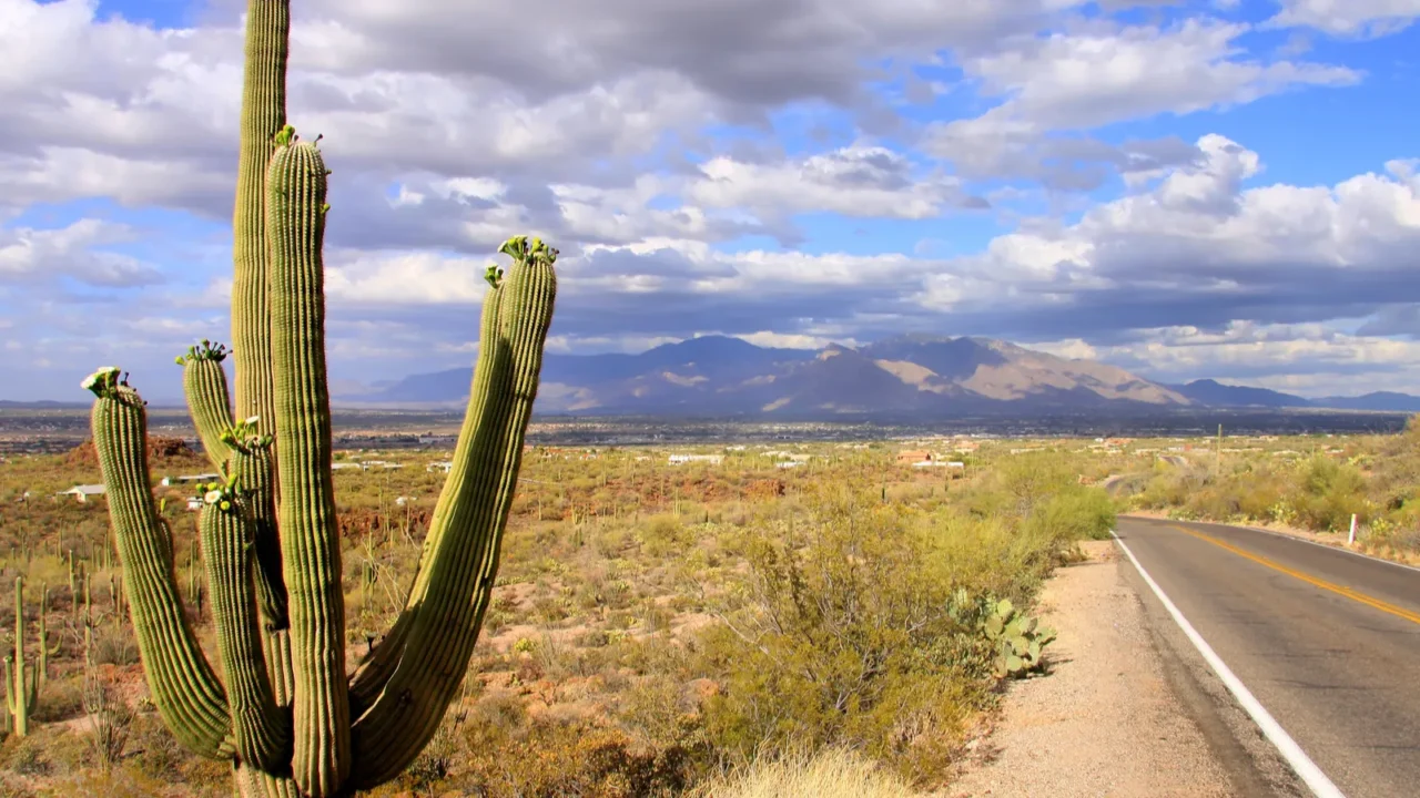
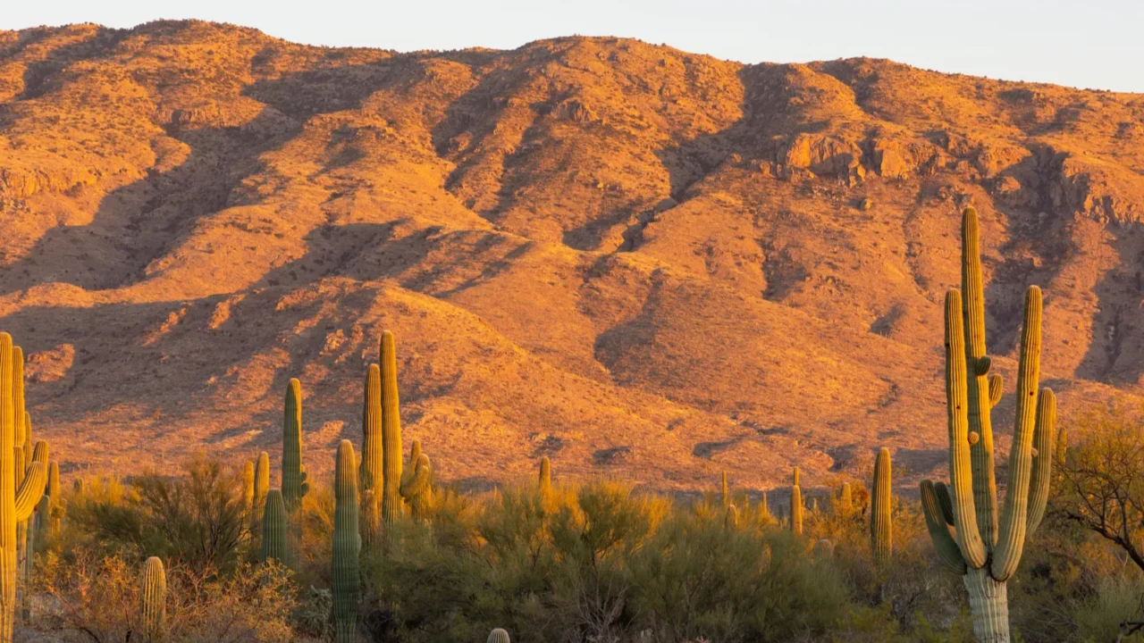
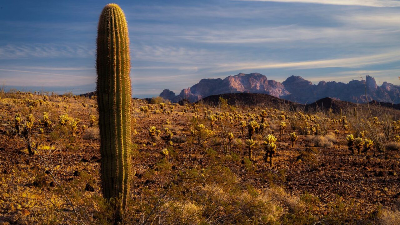
Saguaro National Park
Just outside Tucson, Saguaro National Park protects one of the largest populations of saguaro cactus in the country. These tall plants are found only in the Sonoran Desert and can live for over 100 years.
The park has two districts, one on each side of the city, both with hiking trails and scenic drives. Wildlife is often spotted early in the morning. Visitors often explore the desert trails on foot, especially in cooler months when the sun is less intense.
Petrified Forest National Park
In northeastern Arizona, Petrified Forest National Park offers something different. Here, visitors can see trees that have turned into stone over time. The logs are scattered across an open desert, surrounded by hills with layers of color.
There are several short trails to explore, as well as viewpoints along the park road. The area also has ancient petroglyphs and signs of early settlements. This stop is often less crowded than other parks, which adds to its peaceful feel.
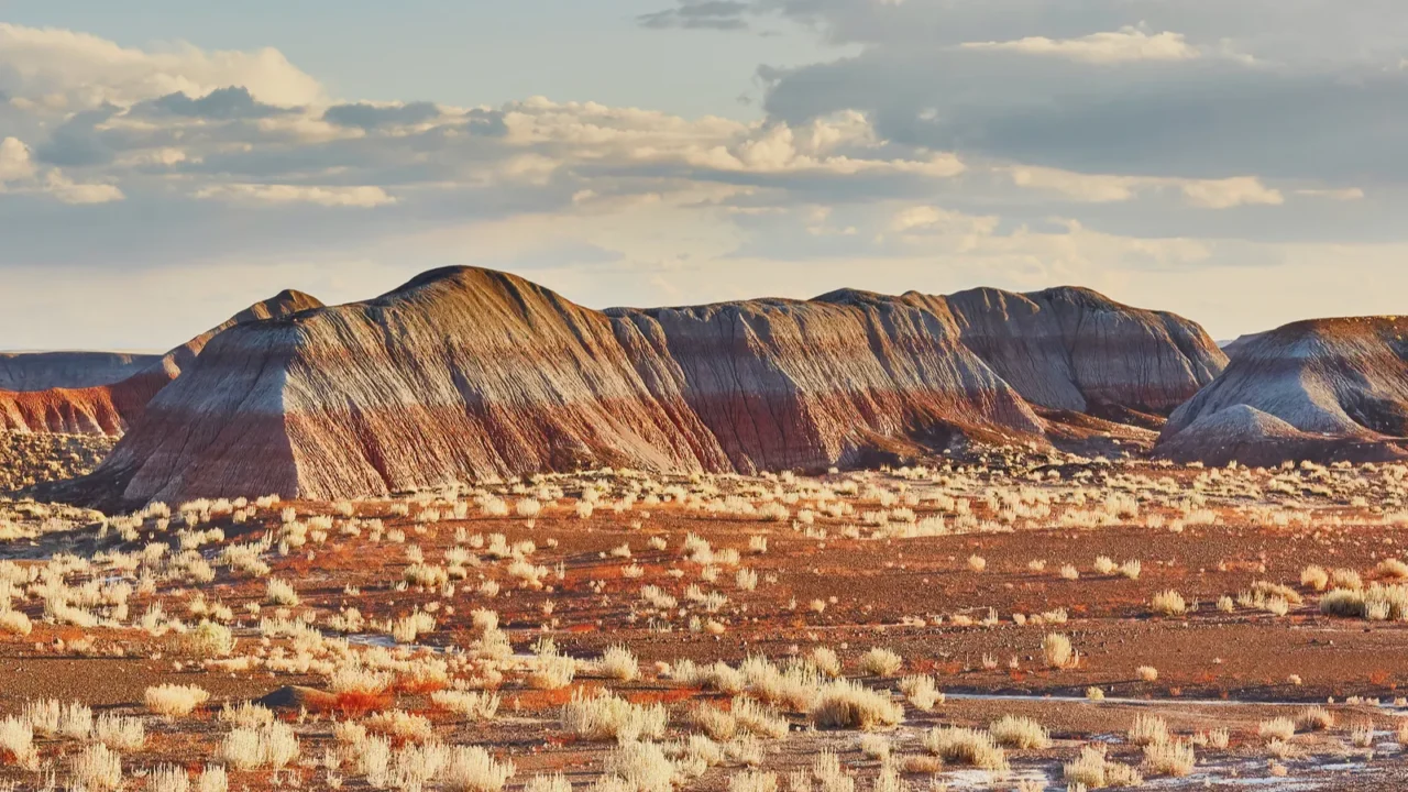
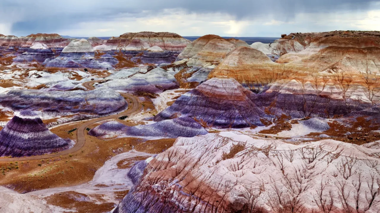
Painted Desert
The Painted Desert stretches across northern Arizona and includes part of Petrified Forest National Park. Its hills and badlands are made of layers of rock that show different shades of pink, gray, and purple. Many travelers stop here during a longer drive, but it’s worth more time.
There are walking trails and overlooks, especially in the park’s northern section. The best time to visit is when the sun is low, as the shadows and light bring out the colors more clearly.

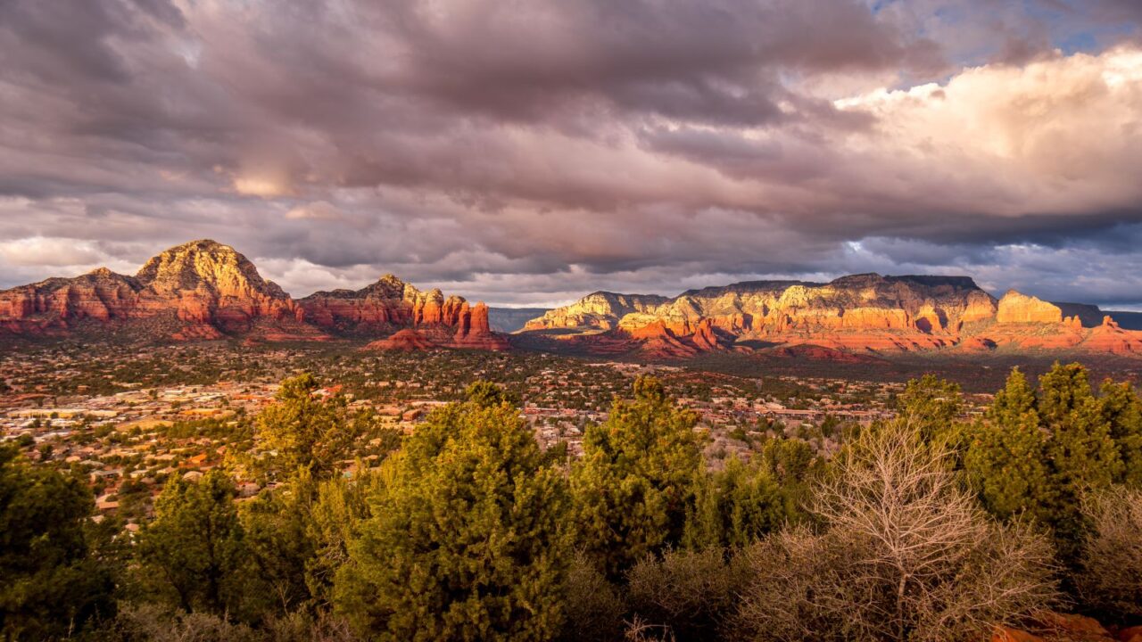
Sedona
Sedona is known for its tall red cliffs and open spaces. The town itself is a mix of art galleries and restaurants, but the nearby trails are what attract many travelers. Places like Cathedral Rock and Bell Rock are popular hikes with rewarding views.
The area also has several scenic drives. While Sedona can get busy during peak times, early morning hikes often feel quiet. The rock formations are shaped by erosion and stand out clearly against the sky.
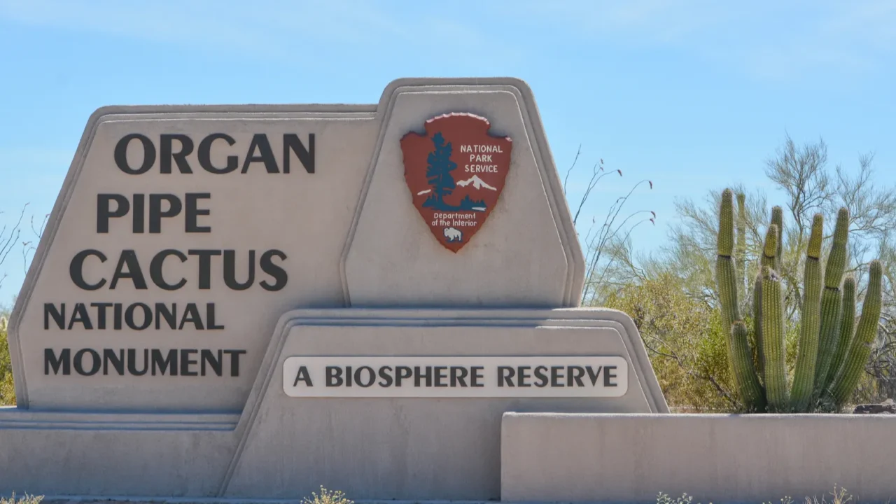
Organ Pipe Cactus National Monument
Close to the border with Mexico, Organ Pipe Cactus National Monument is one of the only places in the U.S. where the organ pipe cactus grows naturally. This tall cactus branches like pipes on an organ and can be seen throughout the park.
There are backcountry roads, walking trails, and camping areas. The desert here is less developed, so visitors often feel a strong sense of distance and quiet. The monument also has signs of early desert life and farming.
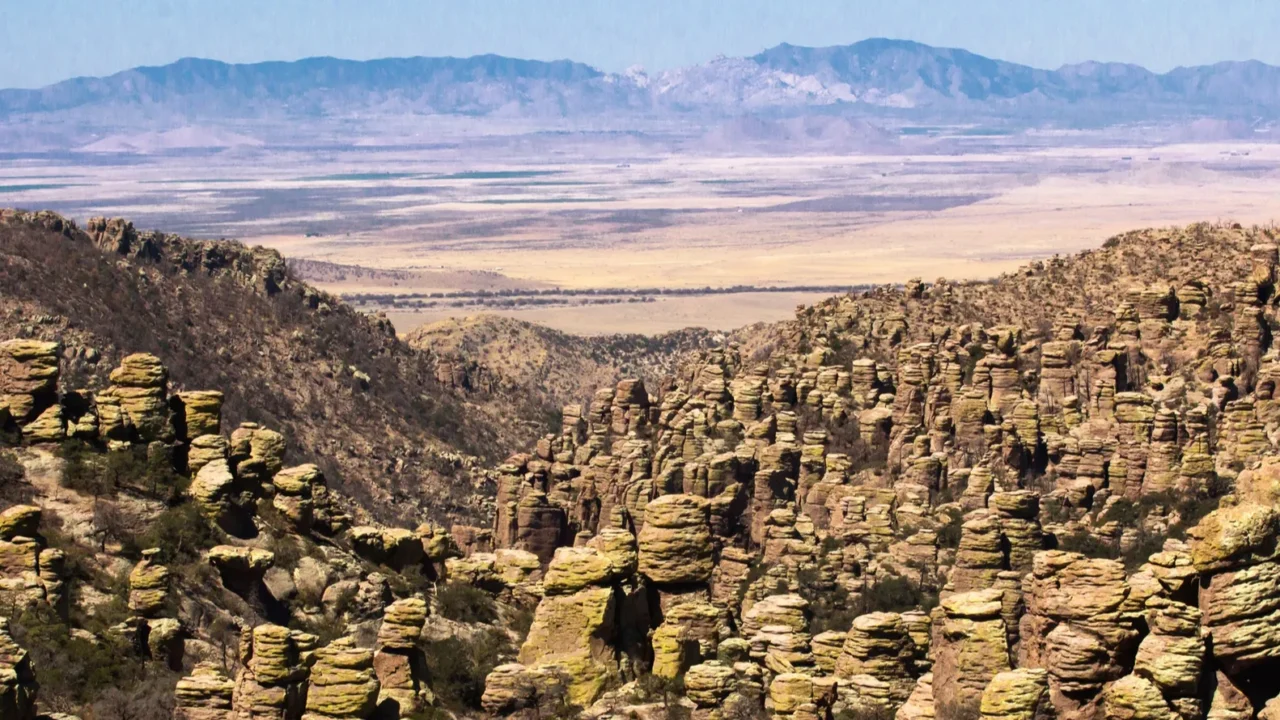
Chiricahua National Monument
Chiricahua National Monument in southeastern Arizona features tall rock spires and balanced boulders. The landscape was formed by ancient volcanic activity, and the rock formations are shaped by erosion.
Several trails pass through this unusual landscape, including both short loops and longer hikes. There is a scenic drive that climbs to a higher viewpoint with views across the mountains. Wildlife like deer and birds are often seen in the area, especially in the early morning or late afternoon.
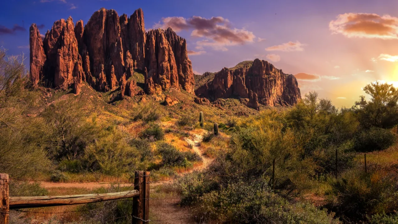
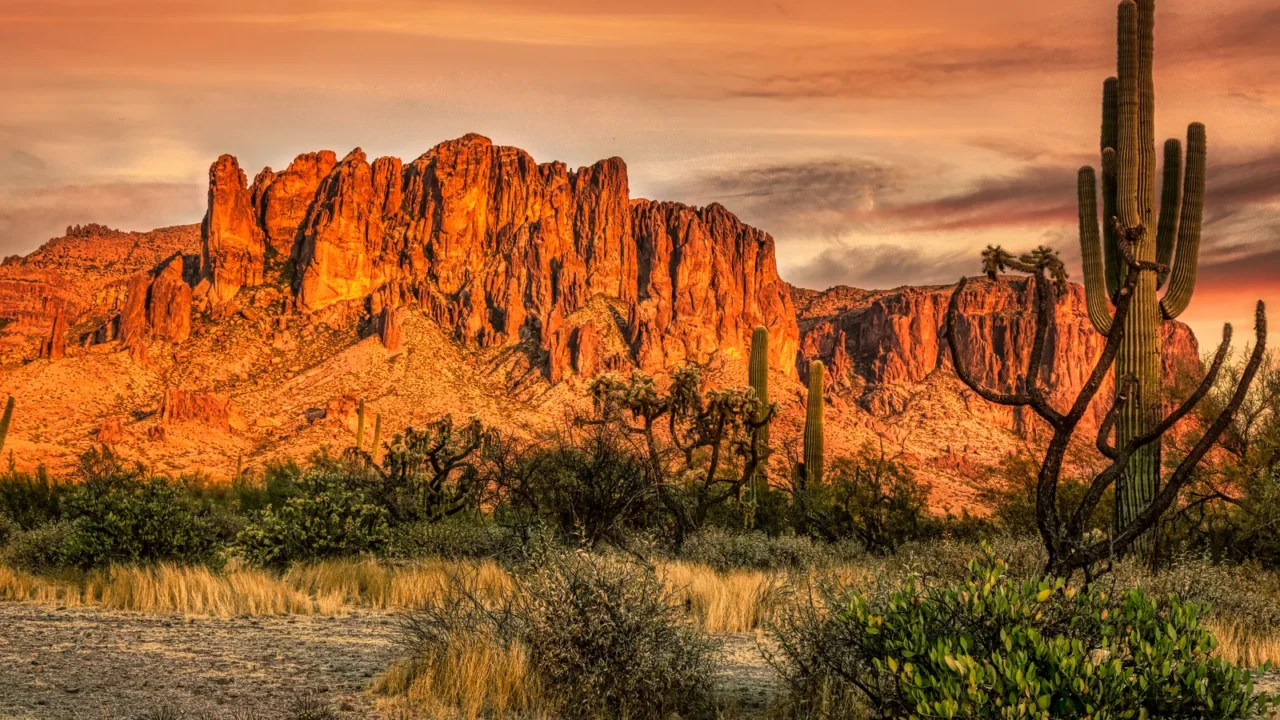
Superstition Mountains
East of Phoenix, the Superstition Mountains offer desert hikes with a backdrop of tall cliffs. The area is known for the Lost Dutchman Mine legend, but most visitors come for the trails and scenery. The mountains have steep slopes, wide views, and desert plants like saguaros and agave.
There are several trailheads, including easy walks and difficult climbs. The light changes quickly in the desert, so many hikers plan for early starts and shaded routes.
Sonoran Desert
The Sonoran Desert covers a large part of southern Arizona. It includes not only saguaros but also other desert plants like ocotillo and cholla. This desert is known for its variety of life and its clear skies.
Several parks and preserves, such as Ironwood Forest and Desert National Wildlife Refuge, give access to walking trails and protected land. Some areas have guided tours, while others are best explored at your own pace with a map and plenty of water.
Red Rock State Park
Red Rock State Park near Sedona is a quiet place to explore red rock formations without large crowds. The park has several walking trails that cross streams, meadows, and rocky areas. Wildlife such as deer and hawks are often seen along the way.
The visitor center has maps, restrooms, and exhibits about local geology and plants. This park is good for travelers looking for an easy day hike with good scenery and a chance to learn more about the desert.
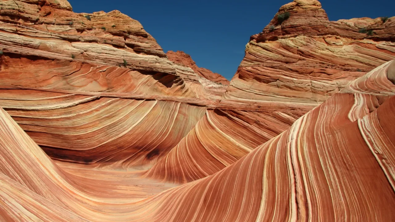
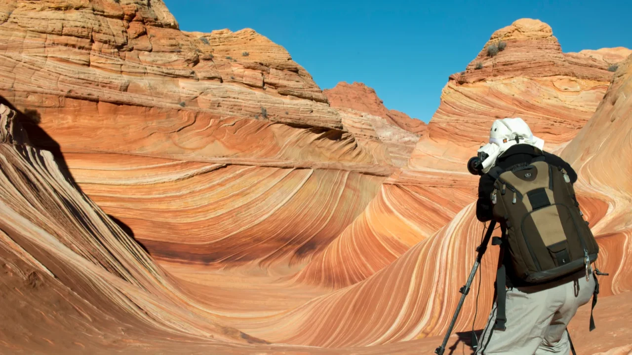
Vermilion Cliffs
The Vermilion Cliffs lie near the Arizona-Utah border, and the area is managed as a national monument. It is known for wide, open land and colorful rock layers. Access can be tricky, and some areas require permits, especially The Wave. But even the surrounding land offers dramatic views and quiet trails.
This is a good stop for experienced hikers or photographers looking for remote desert settings. Proper planning is important due to the lack of nearby services.
Paria Canyon
Paria Canyon offers multi-day hikes through winding sandstone walls and desert streams. The trail begins in Arizona and ends in Utah. Permits are required, and it’s best for experienced hikers. The canyon’s walls shift in color and shape, and the area stays cooler due to its shade and water.
Visitors should plan carefully, as flash floods and navigation can be challenging. Those who complete the route often call it one of the most memorable hikes in the Southwest.
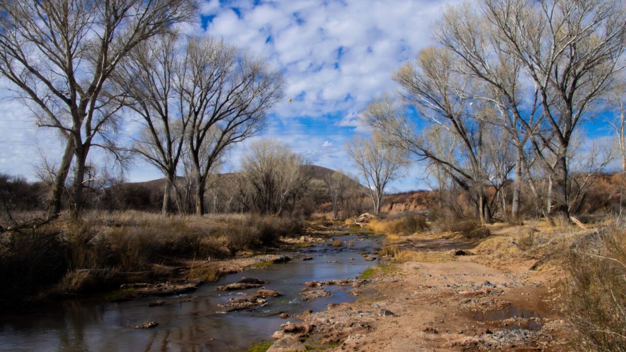
San Pedro Riparian Area
Near the town of Sierra Vista, the San Pedro Riparian Area protects a rare stretch of desert river. The trails follow the San Pedro River, where cottonwood trees grow along the banks. Birds, deer, and even beavers live in the area.
Unlike the open desert, this place stays green longer into the year. It’s a favorite for birdwatchers and those looking for peaceful walks near water. The area is managed to protect both wildlife and historic sites.
If winding roads, hidden gems, and nature’s quiet surprises call your name, this weekend road trip plan was made for you. Pack the car, adventure waits just beyond the bend.
Kofa National Wildlife Refuge
Although part of Kofa is just across the border in California, the Arizona side offers wide desert plains, jagged mountain peaks, and rare desert animals.
The refuge is home to bighorn sheep and large cacti. Roads are rough, and there are few facilities, so this area is best for travelers with off-road vehicles or a desire for remote camping. The views are broad, and the silence is complete. Those who make the trip often come back again.
If wild escapes speak to you, the right state park is just a scroll away. Check how to pick the best one for your long weekend.
Which Arizona desert spot is on your travel list? Let us know in the comments.
Read More From This Brand:
- Dreamiest Lakes to Visit in Minnesota
- The Best Walkable Cities for a Car-Free Getaway
- The Most Iconic Hotel Buildings Around the World
Don’t forget to follow us for more exclusive content right here on MSN.
If you liked this story, you’ll LOVE our FREE emails. Join today and be the first to get stories like this one.
This slideshow was made with AI assistance and human editing.